 |
|||
| back | |||
FACT
FILE
HISTORY  Once the
headquarters of a Bhutanese Governor, the word 'kalim' means King's
Minister and 'Pong' - the stronghold of the King's minister. It is
also called 'Kalibong' or the black spur by the hill people. 'Kalipong'
in local dialect stands for 'Kaulim' which is a fibrous plant which
grows in abundance in this region. The meaning that has found the most
favour is the Lepcha meaning of the name - 'ridge where we play'. It
is said that these local tribesmen used to organise field sports while
not engaged in agricultural pursuits - hence its name. Somewhat
secluded and tucked away in the corner under the big Darjeeling
umbrella, Kalimpong offers a quiet and relaxed holiday against the
backdrop of Kanchenjunga. Once the
headquarters of a Bhutanese Governor, the word 'kalim' means King's
Minister and 'Pong' - the stronghold of the King's minister. It is
also called 'Kalibong' or the black spur by the hill people. 'Kalipong'
in local dialect stands for 'Kaulim' which is a fibrous plant which
grows in abundance in this region. The meaning that has found the most
favour is the Lepcha meaning of the name - 'ridge where we play'. It
is said that these local tribesmen used to organise field sports while
not engaged in agricultural pursuits - hence its name. Somewhat
secluded and tucked away in the corner under the big Darjeeling
umbrella, Kalimpong offers a quiet and relaxed holiday against the
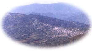
backdrop of Kanchenjunga.Kalimpong was originally part of Bhutan. In 1865, after the Anglo-Bhutan War, it was merged with Darjeeling, and became a sub-division of Darjeeling in 1916, and developed as a hill station. It flourished as a wool trading centre with Tibet till 1950, when the Chinese took over Tibet. It continues to be part of Darjeeling District, and is now an attractive tourist and educational centre. |
|||||||||||||||||||||||||||||
Copyright : Suvankar Sanyal, All Rights Reserved This is a Suvankar Sanyal creation |
|||||||||||||||||||||||||||||